
Sunday, December 31, 2017
Thursday, December 21, 2017

Sunday, November 19, 2017
That's a wrap

Congratulations to everyone on a successful season. We made 597 flights, flew 22476 OLC kilometers, and added three new members and a glider. One of three derelict gliders came back to life, and we have high hopes for the other two for next season.
Thanks to Andy, Dan, David, Dennis, Don, Greg, Henry, Josh, Kari, Karl, Lane, Paul, Peter, Sonny, and Tim who made quick work of disassembling and storing the gliders and mothballing the towplane.
PM is headed for Kari's barn for some work, so it won't be flying at Springfield this winter. There's always skiflying, though.


Thursday, November 9, 2017
Left stick, right pedal
Congratulations to Kari Mettinen, who slipped a Private Pilot flight test into our 2017 season at the very end.

And congratulations to Evan on his first flight test recommendation as CFI.

And congratulations to Evan on his first flight test recommendation as CFI.
Friday, October 27, 2017
Sugarbush Wave
I had a nice wave flight today. Lift was rarely over 1.5 kts. Clouds were few and far between but I did mange to get to 8,300'. Wind was about 40 kts right from Sugarbush. Thank you Rick for towing!
https://www.onlinecontest.org/olc-2.0/gliding/flightinfo.html?dsId=6161120
 Sugarbush and Camels Hump. Adirondacks in the background.
 Union Village Dam in the foreground and my neighborhood.


https://www.onlinecontest.org/olc-2.0/gliding/flightinfo.html?dsId=6161120


Sunday, October 22, 2017
New glider on the field
Congratulations to Gregg on the first flight in his new 1-26!

By my count, this is the 19th glider based at Post Mills.

By my count, this is the 19th glider based at Post Mills.
Saturday, October 21, 2017
6Q is back in the air
Congratulations to Kevin for putting 6Q back in the air after an extended time in its box.


Sunday, October 8, 2017
Wave camp report - October 7
Still more aviation happened today. We woke to pretty nice conditions, blue skies, some cloud, a little wind. Your forecaster was a bit surprised as it did not look like the sounding. The wind on the ground was slightly favoring easterly takeoffs, wind aloft was south south west. There were wave indications, just not in the usual places.
I took off to the east and flew to the Carters, not expecting them to work, but we were seeing some vertical development that looked to have wave influence on the south facing spur of the northern most peak. Indeed I found some rotor, and then wave, and was able to climb to around 8000 feet. However, from the start of the climb, our lovely blue sky was filling in fast, and more worrisome was very low, very wet looking clouds at the south end of the valley. As things were filling in, I descended to below the overcast that was now covering the airport. Cloudbase there was around 5000 feet, but with plenty of lift - so if you wanted to stay up, you could.
There were about ten flights in total, with the high flight near 10,000 feet. The day did end in a bit of rain at 3:00 but good flying was had.
I am less optimistic for tomorrow and Monday, but later in the week could be very nice.
RR
Saturday, October 7, 2017
Gorham early report
Wave camp has started. Here is a report from Rick Roelke.
Driving up through the rain, I did not hold out much hope for the day, but having 1000lbs of Ox in the back, and thinking someone might want it, I soldiered on.
The rain stopped shortly after my arrival, and we could see bits of blue, so it looked like it might work. Walter was delayed due to the weather, but we rigged anyway. Peter Stauble was the wind dummy, with a tow to the carters, not far behind, I did my first self-launch at Gorham and it worked great.
I motored to the top of Mt Hayes, where I found the crescent wave. Very slow at first, getting better with altitude. The carters in the meantime were not turning out to be the easy way. Roy, however, did find his way into the primary from near wildcat after a sporting round with the rotor there. I left the crescent wave at 7k and joined Roy in the primary where I found a brief bit of 8 kts, climbing to 20k for the first diamond of camp. Roy would have me point out that he got above 20k in a "real glider"...
John Good also got high, and then (intentionally) headed down wind to explore four cycles of wave east of the carters, and then landing at Bethel.
I think we had 7ish flights today, good time had by all.
All in all, a good start to camp, particularly after a drive up in the rain...
The big question is what will the weather bring. It looks flyable the next few days, with wave opportunitys, but plagued with excessive moisture. Today we had solid undercast for as far as you could see upwind, but the valley was open all day. So forecasting is difficult. I will tell you it is not optimum conditions, but don't shoot the forecaster if we sneak in a few high flights.
all for now.
RR
Thursday, September 28, 2017

Friday, September 22, 2017

52165 feet
The Perlan team claimed the World Altitude Record earlier this month, and this is probably the first time that a non-rocket-powered glider has made the cover of Aviation Week and Space Technology.


Contest in progress
New Castle, Virginia is a special place for glider pilots.
Today is the second-to-last day of the annual competition known as "New Castle," and whose official title is "Region 4 South."
Evan Ludeman (T8), Dan MacMonagle (EA), and John Good (X) are all competing. This year, as usual, the partying at this contest is better than the weather - and the weather has been very good!
Yesterday John, Evan, and Dan were 2nd, 3rd, and 5th - not bad!
Mountain Flying, Explained, Again
Here is another video describing how airplane pilots can get in trouble flying near mountains.

It is amusing in at least two ways. First, it actually contains some humor, which is unusual for a safety video. But it also contains a fair amount of misinformation, which always brings a smile to my face.
We went through this with AOPA, whose Air Safety Foundation made three attempts to create a lesson on Mountain Flying for power pilots. The final version was OK, and they get credit for correcting their initial errors.
You can’t blame the guys in this video for trying to keep ignorant power pilots away from the turbulence and sink. But why can’t they ever make the distinction between turbulence and sink? And why don’t they ever mention how smooth it can get?
And, of course, they never explain why some pilots are actually attracted to mountain waves.
Here’s a challenge. Let’s collect a list of inaccuracies in the comments. I’ll go first.
Thanks to Andy G for finding the video.
Sunday, September 3, 2017
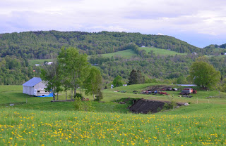
Another visitor to Newmont Farm
Yesterday, Eric made his first off field landing in the northern hemisphere. He chose the Newmont Farm in Fairlee, the fourth club member to do so since 2013. We should put a windsock in that field.

Dennis and Don made quick work of retrieving him, and Eric was back on the field in time to tell his story to the gathered crowd.

Dennis and Don made quick work of retrieving him, and Eric was back on the field in time to tell his story to the gathered crowd.
Monday, July 17, 2017
Empty back seat

It was a beautiful day on Sunday. We had a very efficient operation, due in large part to the hard work of Dakai Zhu who kept us organized on the launch line, ran ropes, kept the golf cart moving, and made sure that every takeoff and landing was logged.
Finally, at the end of the day, he took a couple of short review flights in the 2-33, and on the very last flight of the day, made his first solo. The photo above shows him about to touch down.
Congratulations, Dakai!
The event was well documented by a couple of serious photographers, and the celebration featured an unusual double-dousing ceremony.


Thursday, July 13, 2017
Maine
I'm not certain who started it.
A few years ago, the Post Mills XC milk run to Mt Washington started getting stretched routinely to Old Speck Mountain, the highest point in the Mahoosuc Range. Subsequent trips to the Mahoosucs have shown that they can produce good soaring, albeit a long ways off from Post Mills and surrounded by a whole lot of... not very much. To the West is a lot of water and trees and bears. To the East is, well, even further away from Post Mills.
After a particularly lousy, rainy stretch of weather in a persistently wet and rainy Spring, Wed June 7 was mostly dry and Thurs June 8 finally offered the prospect of decent soaring. Club enthusiasm was high. Spring loaded. Turn out was probably a PM weekday record.
 |
| Grid Time! First Cu peaking over the hills. What's all that uninvited cirrus doing there? |
 |
| Clouds just beyond the copper mine -- time to go! |
 |
| Wind Dummy on tow. |
Nine pilots, mostly shirking work. Nine sailplanes. Hopes for an extra early launch were dashed by slow starting convection. This wasn't too surprising given 3" of recent rainfall. Finally, about 1130, the launch begins. I'm the wind dummy. The ride is pretty smooth so I hang on for 3000. Good thing too -- I had to glide about 5 miles West of PM airport to connect. A slow climb of a few hundred feet gave enough extra margin to move a little further West under some early clouds. I soon got up to 6000.
While climbing, I watched clouds form like stepping stones to the North, ending around Spruce Mtn. I'd checked the accumulated precip maps, and straight North was a good (well, less soaking wet) direction. I thought the Connecticut river valley would start slower and although Cu were forming on the high ground East of the River, the quick start was to take this line North. I expected most of the fleet to head towards the Presidential range and the more ambitious guys to head on up the Mahoosucs. I resolved to meet them after going the long way around via the Canadian border. By the time I got to the high ground near Spruce Mtn, my stepping stones had extended Northward and conditions were strengthening.
Moving along well and about 20 miles short of Newport, VT, I reach the edge of the field of Cu and start bearing right. I end up right on the border skirting large areas of overdevelopment(OD) and then over the boonies between Colebrook and Rangely. I fly extra conservative through here, and it goes well.
I get on the Mahoosuc range at Saddleback Mtn and call EA and JD. They are just a couple of miles behind, also Northbound. We don't make visual contact until somewhere NE of Sugarloaf airport. Sugarloaf is about 130 straight line miles from Post Mills and about as far as I ever dreamed I might go today. Now, the real silliness begins, it becomes apparent (we hadn't discussed plans before flying) that EA and JD are on an out and return record attempt. Today!?! Ugh. I know better. My gut told me this morning that this day was apt to shut off early. No sign of that right now though.
Conditions are fantastic. Bases are 10 grand, the OD has simply vanished (when does that ever happen?). Visibility at cloudbase is limited, which conveniently hides the cirrus that must still be lurking overhead to the South. Out of sight... out of our minds! Dan and Greg have water ballast on board. I'm dry, and I have to scramble. Greenville comes and goes... we should really turn around! I'm unwilling to do so on my own. If I bail early, these two loons actually make it around, I'll kick myself for a month. So I continue to scramble, Northeast.
 |
| Greenville, ME. Not too many glider pilots have seen this place! |
 |
| Moosehead Lake. WTH are we doing here...? |
About the time we get to Moosehead Lake, Dan asks if I know the VT state free O&R record.
"It's about 500K."
"We've got it then."
"You get it when you get home..."
We press Eastward over Yogi and Booboo country. You can't really fly here except on an amazing 10,000 foot day because there is nowhere to land except widely spaced airports. Mt Katahdin is about 25 miles ahead now, easily visible, massive even at this distance. It's 3pm.
Greg: "Hey Tango, I thought you were going to turn at 3."
Me: "I'm waiting on Echo!"
We're over 180 miles out of Post Mills! Finally we all turn together. My guess is that we might get back to Franconia, unless it's really good, or all goes to hell.
 |
| Thermaling up somewhere East of Moosehead Lake. That's T8 at left. |
 |
| Cruising at cloudbase. Good for the moment. |
 |
| EA off my right wing near Indian Pond, Westbound, 159 miles out of Post Mills. View from 8700'. |
 |
| Now the real fun begins... where did the sun go? |
We struggle to get decent final glides to Bethel. I get a marginal glide, and lose it. Dan gets a marginal glide and squeaks it in, Greg fell off on the first attempt, got what must have been the last thermal of the day to make it. I end up ridge soaring some little spurs, waiting on a miracle or a final decision on where to land. I've been eyeballing a private strip in Roxbury that looks like a great little place, nice house right on the runway. "I bet I'll get a great reception there". Lacking a better idea, I give up and land, roll up into the driveway of the house on the runway. Good call. Minutes later I have a cold beer in hand and some new friends: Douten and Donna Thomas. They'd never had a glider drop in before and thought it was pretty neat.
Once on the ground, it's time to start sorting out this mess we've made -- and it's a pretty big mess by Post Mills standards! I'm 98 air miles from Post Mills, but for a whole bunch of reasons, this retrieve has to be by ground. I guesstimate a 3 hour drive one way, which turns out to be unfortunately accurate. Bethel is about 2.5. It gets crazier: it turns out we've put 6 gliders on the ground away from Post Mills today. DC and NT ended up at Dean, DG in a good field near Bradford in the CT river valley. So some of our ground crew are pressed into service for the second time today. Thanks Pete, Tim, Mark & Sonny. Tim, Mark and Karl (no flight log) are the heros who got home so they could start tidying up
 |
| Long way from home... |
Tim and I had T8 in the box and on the road at 10pm. We got home... when we got home (it wasn't quite light yet...).
Thursday, July 6, 2017
Triangles
July 5 was a good day for FAI triangles**. Thanks for towing, Rick!
Dan & Greg join the New England 500K FAI triangle club, which I reckon numbers about 8 pilots and fewer than 20 such flights. These guys have it figured out. Superb flying. Well done!
Evan had a good day, as well. Most of the flight was too involved for sight seeing, but the Green Mtns offered "hero conditions" that allowed a moment of relaxation and a few quick photos.
 |
| T8 Northbound on the Green Mtns. Mt Snow at center. |
 |
| Same location as photo above, looking NE. |
 |
| Same location, looking East. |
 |
| EA approaching NH's lakes region. |
 |
| Lake Winnipesaukee as seen from EA. |
**For courses under 750km, the definition of an FAI triangle is a course defined by three waypoints, with the shortest of three legs being at least 28% of the total distance. The start & finish points must be co-located, and may be either on one leg or at a vertex. If more than 750K, the definition isn't quite that restrictive, but nothing we've needed to worry about in New England. Yet.
Wednesday, June 21, 2017
15 hours 28 minutes
Today is the longest day of the year. Happy Solstice, and Happy Birthday to the Solstice Babies.
Saturday, June 3, 2017

Tuesday, May 30, 2017
Mount Washington O&R
Eric writes:
I enjoyed the opportunity to accompany Greg, Dan, Evan and Tom on a flight in NT from Post Mills to Mount Washington on Sunday. Greg had previously mentioned the idea of conducting lead and follow coaching for PMSC pilots to learn cross country techniques and I felt I was ready to try it. Although I'd had some cross country experience in Australia, New England's rugged landscape had made me shy about venturing out by myself. So I was delighted to be able to fly with a sense of safety, following seasoned pilots on their semi-regular run to Mount Washington.
Although the day was not particularly easy, it was possible to find strong lift, and especially so after we crossed the river into the New Hampshire high country. We crossed at Bradford and headed for Moosilauke. I think Dan scouted an area that looked promising but turned out not to be. Greg eventually found something in the foothills east of the river and we all came over and to join him.
Thus went more or less the whole day, with one pilot or another reporting something and others adjusting their flight to take advantage of it. We climbed twice on the way to Moosilauke and then once just north of the mountain itself. Dan checked southeast of the summit, but there was nothing particularly strong (which is surprising, given the gentle southerly). We then made a long cruise along the Cannon mountain ridge until we found lift south of Franconia. We spent a long time there in weak lift; Greg and someone else were at cloud base but my climb was taking forever. Greg advised we push on, "let's find something stronger."
After that, more long cruises and with widely spaced climbs. This was definitely a new style for me since I would have normally stopped to top up in anything strong ("you never know when you might need it"). At our second climb after leaving Franconia we had Mount Washington Hotel in sight with Mount Washington in the distance. We'd made it in six climbs from Post Mills! We then flew northeast with the Dartmouth Range beneath us and the Presidential Range to our right. We flew past Madison and I recognized all the territory from wave camp last year. Then, after Evan scouted northward only to find a "big blue hole", we gathered and climbed near Gorham and discussed going westward into Vermont.
Somehow though, having accomplished what I'd wanted for the day, coupled with the idea of pushing on in not particularly easy conditions, left me feeling it was time to head back. I said goodbye to the group and set my sights on the breadcrumb trail of alternate airports that would lead safely home.
Flying back seemed straightforward as far as navigation went since I could mostly recognize the landscape from the trip up, but a long stretch of sink on the way to Franconia, followed by a spell of major sink near Cannon Mountain (which I suddenly realized I was on the lee side of) suddenly left me low and considering Franconia airport to be my likely landing spot for the day.
There was lift in the area, but it was uneven and I needed a big climb. After a small climb I ventured west but was completely dissuaded by the heavy, ever-present sink. I returned to Franconia airport even lower; barely pattern altitude. I radioed them that I was a Post Mills pilot trying to return home but might land there if I couldn't get away.
My second try worked out better, I really just persisted in the lift that was there and as I got higher, the lift became stronger and more uniform. I was finally able to climb above Cannon's elevation and find a region of lift/zero-sink that I could proceed south in. And as I went south at mountain height I found more lift, climbed further, and kept heading south. At some point on that leg I was within final glide of home, and I must say it was a great feeling.
Thank you Greg, Evan, and Dan for the wonderful adventure and for encouraging us to stretch our wings and venture cross country.
[Extracted from the PMSC Forum. Here's a video from Eric's cockpit. -Ed.]
Monday, May 29, 2017
Traps that can catch you
On some XC soaring days the areas with few clouds look iffy, and areas where there are plenty of obvious cumulus clouds look inviting. That can be a trap, though, since the numerous clouds can fill in and become an overdeveloped layer with little lift. It takes an hour or so for the layer to evaporate, then the sun reaches the ground again, and new thermals develop. Or not.
Another trap that we are susceptible to when soaring XC is the concept of a landable spot that we keep within range. Of course that's necessary, but not always sufficient. If you get low and have to stay close to the one landable spot in the area, you can't reach lift that is just a bit too far away. Moreover, not all the "landable" spots are desirable. Some are hazardous, albeit better than nothing.
Both of these traps caught me Saturday as I ventured out XC, despite cloudbase being lower than forecast, not much above 5000 MSL - conditions that normally make me stay close to the home airport. After traveling North to outside glide range of home, I met Greg and Dan who seemed to be heading SE. I headed NW to near the Montpelier airport before realizing that that area was overdeveloping. Turned back East too late, and as I got lower had to abandon the better looking clouds and head to the supposed safe spot, Carrier airstrip, South of the Barre stone quarries.
I've never seen that airstrip before, and as I got close to it got a little scare, since it's hard to spot. There was a large flat farm field a bit further North, but I didn't know how tall was the crop that looked like corn. The GPS got me to right over the airstrip though, at about 1000 feet above the runway which is fairly high at 1600 MSL.
Next problem was that this runway is about 50 feet narrow, with various hazards along the sides: rising banks, drop offs, fences, cows, trees, buildings, and vehicles. It's also sloped: rising to the North. As they say, if the slope is obvious from the air then it's significant, and one should land uphill. With light wind, that was fine. The Northernmost third of the runway is a bit wider and flatter, and does not have hazards along the edges, so that's the preferred landing zone.
Never give up though! I found a small bump, and worked it carefully. After some time, gained 100 feet, then more. Eventually got to 4000 MSL (still only 2400 AGL) so explored a bit further, and lost the altitude. Rinse and repeat. That went on for more than an hour, with my mental state alternating between hope and resignation. Never got high enough to reach a better landing spot. Kept losing sight of the airstrip, so used VOR navigation to find it again and again. No, I didn't use the VOR signal, it's just that the (MPV) VOR building is easy to spot visually, and then looking a couple of miles Northward from there helped me re-spot the airstrip.
Finally the clouds broke up and the ground started heating up again. Alas I didn't have the few extra minutes it took for the thermals to restart. But the skies to the NE looked good soon after I landed, of course. Landing was OK, having short wings helps. (And they also make landing out more likely.)


Mr. Carrier was there and friendly. He knows Karl well - Karl flies there often from his home field a few miles West of there. Mr. Carrier also has been to Post Mills, he flies an ultralight out of his field. He's working on widening the runway a bit: bulldozing the embankment on the East edge and moving that material to the dropoff a bit further South on the same East edge.


Driving directions to Carrier's, in case you need it: North on 110 9 miles from Chelsea to "downtown" Washington, turn left by the store, about a mile to the farm (keep right at the forks). Big house and barn. The airstrip is not visible from the road.

Thanks Paul for the retrieve!
- Moshe
Another trap that we are susceptible to when soaring XC is the concept of a landable spot that we keep within range. Of course that's necessary, but not always sufficient. If you get low and have to stay close to the one landable spot in the area, you can't reach lift that is just a bit too far away. Moreover, not all the "landable" spots are desirable. Some are hazardous, albeit better than nothing.
Both of these traps caught me Saturday as I ventured out XC, despite cloudbase being lower than forecast, not much above 5000 MSL - conditions that normally make me stay close to the home airport. After traveling North to outside glide range of home, I met Greg and Dan who seemed to be heading SE. I headed NW to near the Montpelier airport before realizing that that area was overdeveloping. Turned back East too late, and as I got lower had to abandon the better looking clouds and head to the supposed safe spot, Carrier airstrip, South of the Barre stone quarries.
I've never seen that airstrip before, and as I got close to it got a little scare, since it's hard to spot. There was a large flat farm field a bit further North, but I didn't know how tall was the crop that looked like corn. The GPS got me to right over the airstrip though, at about 1000 feet above the runway which is fairly high at 1600 MSL.
Next problem was that this runway is about 50 feet narrow, with various hazards along the sides: rising banks, drop offs, fences, cows, trees, buildings, and vehicles. It's also sloped: rising to the North. As they say, if the slope is obvious from the air then it's significant, and one should land uphill. With light wind, that was fine. The Northernmost third of the runway is a bit wider and flatter, and does not have hazards along the edges, so that's the preferred landing zone.
Never give up though! I found a small bump, and worked it carefully. After some time, gained 100 feet, then more. Eventually got to 4000 MSL (still only 2400 AGL) so explored a bit further, and lost the altitude. Rinse and repeat. That went on for more than an hour, with my mental state alternating between hope and resignation. Never got high enough to reach a better landing spot. Kept losing sight of the airstrip, so used VOR navigation to find it again and again. No, I didn't use the VOR signal, it's just that the (MPV) VOR building is easy to spot visually, and then looking a couple of miles Northward from there helped me re-spot the airstrip.
Finally the clouds broke up and the ground started heating up again. Alas I didn't have the few extra minutes it took for the thermals to restart. But the skies to the NE looked good soon after I landed, of course. Landing was OK, having short wings helps. (And they also make landing out more likely.)


Driving directions to Carrier's, in case you need it: North on 110 9 miles from Chelsea to "downtown" Washington, turn left by the store, about a mile to the farm (keep right at the forks). Big house and barn. The airstrip is not visible from the road.


- Moshe
Monday, May 15, 2017
Going Long
I've been shopping for record weather on the Appalachian ridges.
The forecast surface charts for May 8 had the look of a classic ridge day, with one or two wrinkles to keep me guessing. The low and high pressure centers were forecast to be well positioned & strong enough but very slow moving (not necessarily a bad thing). The jet stream was forecast to track roughly over Tazewell (that is, well South) with 500 mB winds at around a hundred NW. 6000' wind forecast was perfect from Lock Haven, PA to Gate City, VA. Lower level wind forecasts were a little soft and too Westerly. Stability was low, air was dry, forecasting a great thermal day but all blue at the South end. So not necessarily a record day, but definitely a long strong soaring day covering a lot of real estate. I made the decision to go on Friday evening. Saturday I drove to Mifflin Co airport in the rain.
The front blew through Sunday afternoon. A bunch of other New England glider pilots are at Mifflin Co. for a club encampment and we all go fly. I had a nice little rip around Jack's, Shade & Tuscarora, got too aggressive on the upwind transition to Shade at 6pm and landed at Mifflintown airport, 13 air miles from Mifflin Co. That really annoyed me, as the plan was to leave the ship together and watered overnight, and get some real sleep. John Good came and fetched me by trailer, and accomplished the task so speedily that we got back & rigged again in daylight. Watering was put off until after dinner. I hoped that maybe the extra work would make for sound sleep. No dice. I might have slept an hour. I was pretty wired.
Monday morning at 0630, the sock is limp. Reports from Lock Haven, Altoona, Bedford and University Park report similarly light conditions. Darn. I tell (our tow pilot) Brian "no rush". About 0930 I suggest: "Go get your airplane." He laughs (he's convinced this is a dry run), says "I'll go check the ridge", which he does. He returns, reporting that leaves are still. I'm ready and my weather sense says the ridge ought to be waking up about now, so I saddle up and go, getting airborne at 09:58 and taking a 1000' tow to Jack's Mtn. Initial conditions are about 12 - 15 kts WNW with very light convection starting. Brian's right, those tiny new Spring leaves aren't moving at all and it's well short of record conditions.


Clouds end just North of Mountain Grove and it's time to test these blue conditions out, so I climb to 6500 (5.8 kts avg) and glide to Coles Mtn, looking for another climb in the blue to glide the direct route across Covington, high. Ingalls airport (which is on top of a mountain) reports wind 290-ish at 11, which is a little on the soft side for this sort of mission. I shift down a gear. At Coles Mtn, I haven't hit another good climb, so I decide to divert to the Ingalls ridge. I get the thermal I need at Big Knob, then I go back on the direct route (Lick Mtn) just South of Covington. Not in a hurry here. I'm doing a lot of looking at terrain and comparing to all my Google Earth-ing and other recon work.

On the Southern side of the Covington gap is Peters Mtn. If you wanted to build a ridge for speedy and efficient soaring, you would do well to start by studying Peters. Even in today's less than ideal conditions, head wind component and all, it's good for 115 mph ground speed. All I have to do is hang on and keep cinching down my belts. At Tazewell, VA I make the turn at 13:54. It wasn't too hard to resist the temptation to head across the Tazewell gap. I've already signed up for a 500K return flight starting at 2pm. Do I really want to trade up to 650K at 3pm? Maybe not. North I go. On the Northbound trip I've got a tailwind component and I press to see what I can make my glider do. I run out of nerve at 166 mph. It was pretty rough in there! Nearing Covington, the wind slacks off again, but it never gets worrisome.


A 7 kt thermal at Covington, one more near the Hopewell gap and mostly porpoise flying in thermals to Cumberland. Back on the ridges until halfway up Nittany Mtn I throw in the towel, the wind is 270(!) and it's overcast. So I bail on the task (1250 diplome another day...), head down Evitts to collect my last declared turn, jog over to Tussey at Bedback for variety and spend my return trip down Raystown taking in the view and just enjoying the ride. Nearing Reedsville, I spin the numbers on the computer and realize I can probably run up my OLC score to 1500 km by dusk, and that becomes the final objective for the day. It works, rolling over 1501 on my computer about 14 miles out of Mifflin Co. with the sun right on the ridge. The airport beacon lights up as I cross the Reedsville gap, I click the mic to turn on the runway lights, strafe a couple of guys on the tarmac with water ballast and call it a day. I won't be forgetting this one any time soon.


OLC Flight Log
Even longer flights by others:
Brian Milner, 2100 km
Helmut Bauer, 1800 km
Dale Kramer, 1600 km
Adam Zieba, 1600 km
Brian Collins, 1600 km
And of course, there are the guys who figured it out first:
O&Rographic (1972)
(Check back later -- I'll add more refs as I dig them out)
-Evan Ludeman
The forecast surface charts for May 8 had the look of a classic ridge day, with one or two wrinkles to keep me guessing. The low and high pressure centers were forecast to be well positioned & strong enough but very slow moving (not necessarily a bad thing). The jet stream was forecast to track roughly over Tazewell (that is, well South) with 500 mB winds at around a hundred NW. 6000' wind forecast was perfect from Lock Haven, PA to Gate City, VA. Lower level wind forecasts were a little soft and too Westerly. Stability was low, air was dry, forecasting a great thermal day but all blue at the South end. So not necessarily a record day, but definitely a long strong soaring day covering a lot of real estate. I made the decision to go on Friday evening. Saturday I drove to Mifflin Co airport in the rain.
The front blew through Sunday afternoon. A bunch of other New England glider pilots are at Mifflin Co. for a club encampment and we all go fly. I had a nice little rip around Jack's, Shade & Tuscarora, got too aggressive on the upwind transition to Shade at 6pm and landed at Mifflintown airport, 13 air miles from Mifflin Co. That really annoyed me, as the plan was to leave the ship together and watered overnight, and get some real sleep. John Good came and fetched me by trailer, and accomplished the task so speedily that we got back & rigged again in daylight. Watering was put off until after dinner. I hoped that maybe the extra work would make for sound sleep. No dice. I might have slept an hour. I was pretty wired.
Monday morning at 0630, the sock is limp. Reports from Lock Haven, Altoona, Bedford and University Park report similarly light conditions. Darn. I tell (our tow pilot) Brian "no rush". About 0930 I suggest: "Go get your airplane." He laughs (he's convinced this is a dry run), says "I'll go check the ridge", which he does. He returns, reporting that leaves are still. I'm ready and my weather sense says the ridge ought to be waking up about now, so I saddle up and go, getting airborne at 09:58 and taking a 1000' tow to Jack's Mtn. Initial conditions are about 12 - 15 kts WNW with very light convection starting. Brian's right, those tiny new Spring leaves aren't moving at all and it's well short of record conditions.
 |
| Moments After the Start. Southbound on Jack's Mtn |
My declared course is 1400 km, give or take: Evitts Mtn (South end), Talladega Bowl (near Lock Haven) and Tazewell Gap (Southern VA, a little over 500 km straight line from Mifflin Co). I hit my start on Jack's at 10:04, cruise down Jacks at 80 kts, jog over the Raystown, fly Raystown to within sight of the large open field at the South end, thermal up and make the transition to Tussey... just barely (my inner Flight Instructor is annoyed & says "see me after class, Evan"). Tussey and Evitts go well and nearing the end of Evitts at 11:10 I make the decision to fly the task in reverse order, heading towards Tazewell first.
 |
| Anatomy of a Well Executed Upwind Transition. Jack's to Raystown at Mill Creek PA. |
The day strengthens. It takes two thermals to cross Cumberland and Keyser to New Creek Mtn, home to 52 new and very imposing windmills. Another thermal to Hopewell Gap, then a continuous run of 93 miles @ 104 mph to Mountain Grove. Turbulence is the speed limiting factor here. Thermals are strong and the ride is getting brutal.

Tilting at Windmills on New Creek Mountain.

A little South of Hopewell Gap. Speed and Beauty.
Clouds end just North of Mountain Grove and it's time to test these blue conditions out, so I climb to 6500 (5.8 kts avg) and glide to Coles Mtn, looking for another climb in the blue to glide the direct route across Covington, high. Ingalls airport (which is on top of a mountain) reports wind 290-ish at 11, which is a little on the soft side for this sort of mission. I shift down a gear. At Coles Mtn, I haven't hit another good climb, so I decide to divert to the Ingalls ridge. I get the thermal I need at Big Knob, then I go back on the direct route (Lick Mtn) just South of Covington. Not in a hurry here. I'm doing a lot of looking at terrain and comparing to all my Google Earth-ing and other recon work.


Seneca Rock (in shadow at center) on the Northbound leg.

Scherr WV Below. New Creek Mtn in distance.
Thermal Soaring Preferred Here!
A 7 kt thermal at Covington, one more near the Hopewell gap and mostly porpoise flying in thermals to Cumberland. Back on the ridges until halfway up Nittany Mtn I throw in the towel, the wind is 270(!) and it's overcast. So I bail on the task (1250 diplome another day...), head down Evitts to collect my last declared turn, jog over to Tussey at Bedback for variety and spend my return trip down Raystown taking in the view and just enjoying the ride. Nearing Reedsville, I spin the numbers on the computer and realize I can probably run up my OLC score to 1500 km by dusk, and that becomes the final objective for the day. It works, rolling over 1501 on my computer about 14 miles out of Mifflin Co. with the sun right on the ridge. The airport beacon lights up as I cross the Reedsville gap, I click the mic to turn on the runway lights, strafe a couple of guys on the tarmac with water ballast and call it a day. I won't be forgetting this one any time soon.

Raystown.

Windmills in Motion.
Tearing it up on Peters Mtn., Northbound.
How sweet it is. A half hour segment showing Tussey, Raystown,
Jacks Mtn ridges in (relatively) smooth late afternoon conditions.
Even longer flights by others:
Brian Milner, 2100 km
Helmut Bauer, 1800 km
Dale Kramer, 1600 km
Adam Zieba, 1600 km
Brian Collins, 1600 km
And of course, there are the guys who figured it out first:
O&Rographic (1972)
(Check back later -- I'll add more refs as I dig them out)
-Evan Ludeman
Subscribe to:
Posts (Atom)


