Showing posts with label Tim. Show all posts

Saturday, April 19, 2025

Wave Flight

 Tim writes about April 17:

Actually, it was a rotor/wave flight.

It was a tough start.  There were few clouds to start and those quickly evaporated.  I took a high tow (5K) to the west because if I didn't connect off tow I would have a second chance downwind of the airport.  Sure enough, I couldn't find wave lift near Miller Pond so I headed downwind before I got too low.  I was able to work rotor while drifting downwind.  I guess the wind was about 30 knots.  The lift was sometimes 14 knots in half a turn and minus 14 knots in the other half.  I was able to climb to about 8500 feet as I drifted almost to Mt. Cube.  Was able to work scraps of wave to about 9500 feet but was never well established.  Wind was now about 45 knots.

Moosilauke, Franconia Ridge and Mt. Washington from 9,500 feet

After 2.5 hours I had enough and was going to "declare victory" and land.  Pushing upwind northwest of the airport I found a spot of well-organized rotor lift that turned into wave and went up to 11,000 feet.  This was real wave lift - smooth, consistent and spread over a large area.  Even though there were no cloud markers you could fly carefully and stay in lift (the sink wasn't bad either).  I was able to explore a little and got up to 14,000 feet in the 60 knot wind.  The high winds made it slow to get around but the view was spectacular.  There wasn't a cloud from Canada to Massachusetts.

Below is the SkySight wave prediction and a satellite image from early morning.  And check out this flight to Mt. Washington in a motor glider.


Saturday, August 8, 2020

Isaias Wave

Hurricane Isaias blew through Tuesday and left enough wind on Thursday to generate wave behind Mt. Washington, I wanted to try a flight to Mt. Washington.  After a late start (2:15) because VW was extracting money from the tow pilot to fix his car, I started thermaling northwards.  Thermals were consistent but cloud base was only 5,500-6,000' which is on the low side of my comfort level for a trip to W (Mt. Washington).  I took my time and arrived at W around 4:00.  Ridge lift was good on the Presidentials and I ridge soared the face contemplating my next move.  There were no clouds between the summit of W and the Carters to indicate wave or any other kind of lift.   I wasn't sure I wanted to commit to being down wind of and lower than the Presidentials if I couldn't find wave this late in the day.  But I came this far...  I jumped the ridge into Huntington Ravine.  In less about 90 seconds I felt the first indication of lift at 5,900'.  A quick 180 to point into the wind and I was in zero sink and then climbing at 1 kt.  I was surprised how close the wave was to the summit.  1 kt soon turned into 2 kts then 3 kts by the time I got to 10,000' I was climbing at 8 kts.

Huntington Ravine climbing at 1 kt.

View of Carters - no wave clouds

10,000' climbing at 7.8 kts

After 45 minutes I was just shy of 18,000' and climbing at 1.5 kts.  It was almost 5:00 so it was time to head home.  I dialed Post Mills into the Oudie and was happy to see that even with a 35 kt headwind I had Post Mills with 6,000' to spare - my kind of final glide!

17,500' - Start of final glide

After flying carefully to Franconia to make sure the Oudie wasn't lying to me,  I finished the final glide into PM at 95-100 kts and still arrived with 4,000' to spare.

It was a great flight in thermal, ridge and wave lift and I made it home for dinner.  Thank you Rick for towing and crewing.

Image preview

Tuesday, September 10, 2019

Shear Wave


6,600' over Post Mills on Sunday
Sunday mark the beginning of wave season in New England.  It was kind of windy, thermals were generally weak, cloud base was low and the clouds sort formed streets (perpendicular to the wind).  The first 2 hours of my flight I tried to thermal to cloud base and then look for wave.  Most of the time was spent trying to get to cloud base in the weak thermals and avoiding the strong areas of sink.  Since the wind was out of the northwest, when I got to cloud base I would try to move toward the northeast (mistake) and generally found sink.

I found a strong thermal over Rich Starr's house (I guess there's a lot of hot air around there) that took me to cloudbase over the east ridge and from there I was able to transition to wave at about 5,000'.  When I looked around I noticed I was on the southwest side of the cloud street and the glide computer said the wind was 280 degrees at 20 kts.  Below 5,000' the wind was 320 degrees at 10 kts.

I think what was happening was there was cloud street that runs perpendicular to the wind (320 to 140 degrees).  The thermals push up into the inversion at 5,000' and forms a "ridge".  The inversion layer is moving at 20 kts from 280 degrees and hits the "ridge" at a 40 degree angle and has to go up and over the "ridge" forming the shear wave (see cloud street wave).

While the OLC points and the maximum altitude were unremarkable, it was a really fun flight.


Friday, October 12, 2018

Altitude Record

It isn't official yet, but it seems that Tim Chow has broken the 49-year-old New Hampshire altitude record!

On October 9, Tim (BU) took off from Gorham and released over Mount Hayes at 2200 feet AGL.  He found some weak lift that took him up to Berlin where he got to 8000 feet MSL.  From there he transitioned to the Mount Washington primary (in the vicinity of the Wildcat ski area) and started climbing at about 8 knots on the averager.  He moved forward as he got higher and eventually topped out at 33031 feet MSL, which exceeds the old record by a little more than 1000 feet.  His high point was remarkably far upwind, about halfway between Route 16 and the summit of Mount Washington.


Tim's low release allowed him to claim the altitude gain record of 30046 feet.  The previous record (26271 feet) has been held by Evan since 2015.

Paradoxically, it was a warm day.  The sounding shows a very deep stable layer and ideal winds.


Congratulations, Tim!

Wednesday, October 3, 2018

Transition to Wave at PM

Here is the log of my flight last Saturday where I transitioned to wave a few miles north of PM airport.  I transitioned from thermals to wave at about 6,000' (cloud base) and then climbed in wave to about 9,000'.
The wind was out of the west (left) and I was flying directly downwind.  I was able to climb a little in 2 broken thermals (thermals are typically broken up by the rotor).  The third thermal was particularly strong (8 kts) and took me to cloud base.  I then pushed forward and continued to climb while I "ridge soared" the front of the clouds.  As is often the case the clouds drifted downwind.  Often more clouds will form up wind and you should push forward to get up wind of the new clouds.  In this case it looks like a jump downwind to another wave peak.

I was able to go to Franconia in wave without losing much altitude but I fell out of the wave (I thought for sure I would find better wave there) and had to thermal back to PM.

Here is the entire flight log:
Here is the Skew-t for the day:

The satellite image shows cloud streets (parallel to the wind) and not the usually wave bands (perpendicular to the wind):


Friday, October 27, 2017

Sugarbush Wave

I had a nice wave flight today.  Lift was rarely over 1.5 kts.  Clouds were few and far between but I did mange to get to 8,300'.  Wind was about 40 kts right from Sugarbush.  Thank you Rick for towing!

https://www.onlinecontest.org/olc-2.0/gliding/flightinfo.html?dsId=6161120


 Sugarbush and Camels Hump.  Adirondacks in the background.
Union Village Dam in the foreground and my neighborhood.


Thursday, July 13, 2017

Maine

I'm not certain who started it.

A few years ago, the Post Mills XC milk run to Mt Washington started getting stretched routinely to Old Speck Mountain, the highest point in the Mahoosuc Range.  Subsequent trips to the Mahoosucs have shown that they can produce good soaring, albeit a long ways off from Post Mills and surrounded by a whole lot of... not very much.  To the West is a lot of water and trees and bears.  To the East is, well, even further away from Post Mills.

After a particularly lousy, rainy stretch of weather in a persistently wet and rainy Spring, Wed June 7 was mostly dry and Thurs June 8 finally offered the prospect of decent soaring.  Club enthusiasm was high. Spring loaded.  Turn out was probably a PM weekday record.

Grid Time!  First Cu peaking over the hills.  What's all that uninvited cirrus doing there?

Clouds just beyond the copper mine -- time to go!

Wind Dummy on tow.


Nine pilots, mostly shirking work.  Nine sailplanes.  Hopes for an extra early launch were dashed by slow starting convection.  This wasn't too surprising given 3" of  recent rainfall.  Finally, about 1130, the launch begins.  I'm the wind dummy. The ride is pretty smooth so I hang on for 3000.  Good thing too -- I had to glide about 5 miles West of PM airport to connect.  A slow climb of a few hundred feet gave enough extra margin to move a little further West under some early clouds.  I soon got up to 6000.

While climbing, I watched clouds form like stepping stones to the North, ending around Spruce Mtn. I'd checked the accumulated precip maps, and straight North was a good (well, less soaking wet) direction.  I thought the Connecticut river valley would start slower and although Cu were forming on the high ground East of the River, the quick start was to take this line North.  I expected most of the fleet to head towards the Presidential range and the more ambitious guys to head on up the Mahoosucs.  I resolved to meet them after going the long way around via the Canadian border.  By the time I got to the high ground near Spruce Mtn, my stepping stones had extended Northward and conditions were strengthening.

Moving along well and about 20 miles short of Newport, VT, I reach the edge of the field of Cu and start bearing right.  I end up right on the border skirting large areas of  overdevelopment(OD) and then over the boonies between Colebrook and Rangely.  I fly extra conservative through here, and it goes well.

I get on the Mahoosuc range at Saddleback Mtn and call EA and JD.  They are just a couple of miles behind, also Northbound.  We don't make visual contact until somewhere NE of Sugarloaf airport. Sugarloaf is about 130 straight line miles from Post Mills and about as far as I ever dreamed I might go today.  Now, the real silliness begins,  it becomes apparent (we hadn't discussed plans before flying) that EA and JD are on an out and return record attempt.  Today!?!  Ugh.  I know better.  My gut told me this morning that this day was apt to shut off early.  No sign of that right now though.

Conditions are fantastic.  Bases are 10 grand, the OD has simply vanished (when does that ever happen?). Visibility at cloudbase is limited, which conveniently hides the cirrus that must still be lurking overhead to the South.  Out of sight... out of our minds!  Dan and Greg have water ballast on board.  I'm dry, and I have to scramble.  Greenville comes and goes... we should really turn around!  I'm unwilling to do so on my own.  If I bail early, these two loons actually make it around, I'll kick myself for a month.  So I continue to scramble, Northeast.

Greenville, ME.  Not too many glider pilots have seen this place!

Moosehead Lake.  WTH are we doing here...?

About the time we get to Moosehead Lake, Dan asks if I know the VT state free O&R record.

"It's about 500K."

"We've got it then."

"You get it when you get home..."

We press Eastward over Yogi and Booboo country.  You can't really fly here except on an amazing 10,000 foot day because there is nowhere to land except widely spaced airports.  Mt Katahdin is about 25 miles ahead now, easily visible, massive even at this distance.  It's 3pm.

Greg: "Hey Tango, I thought you were going to turn at 3."

Me: "I'm waiting on Echo!"

We're over 180 miles out of Post Mills!  Finally we all turn together.  My guess is that we might get back to Franconia, unless it's really good, or all goes to hell.


Thermaling up somewhere East of Moosehead Lake.  That's T8 at left.
Cruising at cloudbase.  Good for the moment.

EA off my right wing near Indian Pond, Westbound, 159 miles out of Post Mills.
View from 8700'.
The first 40 or so miles on the return go well.  Fast & efficient, we're really enjoying this ride.  Past Greenville, it starts to look like trouble.  Sugarloaf Mtn is 100% shaded in OD.  Worse, the only sun on the ground leads off into Canada.  We can't see much further down the Mahoosucs, maybe it's localized.  Later: nope.  We get right down on the rocks at Bigelow Mtn, crawl around on Sugarloaf until we all climb out when the sun peeks through, a little.  But we're slow and the OD is solid to the Presidentials.  The wind shifts from SW to South, and that's even worse news.  That's marine air coming in now and it not only kills convection, it's creating the convergence that sustains the OD, even in the absence of convection.  Somewhere up on top of the OD is the cirrus deck we ignored earlier.  That's three strikes.

Now the real fun begins... where did the sun go?

We struggle to get decent final glides to Bethel.  I get a marginal glide, and lose it.  Dan gets a marginal glide and squeaks it in, Greg fell off on the first attempt, got what must have been the last thermal of the day to make it. I end up ridge soaring some little spurs, waiting on a miracle or a final decision on where to land.  I've been eyeballing a private strip in Roxbury that looks like a great little place, nice house right on the runway.  "I bet I'll get a great reception there".  Lacking a better idea, I give up and land, roll up into the driveway of the house on the runway.  Good call.  Minutes later I have a cold beer in hand and some new friends: Douten and Donna Thomas.  They'd never had a glider drop in before and thought it was pretty neat.

Once on the ground, it's time to start sorting out this mess we've made -- and it's a pretty big mess by Post Mills standards!  I'm 98 air miles from Post Mills, but for a whole bunch of reasons, this retrieve has to be by ground.  I guesstimate a 3 hour drive one way, which turns out to be unfortunately accurate.  Bethel is about 2.5.  It gets crazier: it turns out we've put 6 gliders on the ground away from Post Mills today. DC and NT ended up at Dean, DG in a good field near Bradford in the CT river valley.  So some of our ground crew are pressed into service for the second time today.  Thanks Pete, Tim, Mark & Sonny.  Tim,  Mark and Karl (no flight log) are the heros who got home so they could start tidying up

Long way from home...
Tim and I had T8 in the box and on the road at 10pm.  We got home... when we got home (it wasn't quite light yet...).

Tuesday, January 3, 2017

New Year's Day Flight


I had a nice wave flight to celebrate the New Year.  Took a long tow and could only find weak wave behind Okemo Mountain.  Moved upwind of Okemo because the clouds looked better, and was able to climb while heading south almost to Mt. Snow.  I think the wave system was well establish to the west (from New York) as can be seen in the satellite images.  Okemo Mountain must have interfered with the established wave resulting in the poor climbs east of the mountain.  Maximum altitude was about 15,000'.

Stratton Mountain in the shade.


Mt. Ascutney is in the Center.  VSF, CMH, and Lake Sunapee are visible in the right pane.


Monday, September 12, 2016

911 Wave Flight

Wave season has started (AT).


Tuesday, March 15, 2016

Wave Flights - March 12

Saturday was a warm, cloudless, wave day.  Tim (AT), Tom (2W), Dan (EA), Evan (T8), and Jerry and Larry (i1) flew out of Springfield VT (VSF) with the assistance of Andy L. in the Pawnee.  Evan found the highest climb to 16,000'.

I (Tim) took the first tow around 11 AM followed by Tom.  We found week wave to 8,500'.  I was in the primary and Tom in the secondary.  At 12:40 the wave shut off and sent us scrambling to find lift.  I hung out by ridge soaring the west face of Okemo until the wave lift returned about 20 minutes later.  Tom never fully recovered and landed about an hour later.

I found the Okemo wave to have a very short wavelength.  My climb was only 2.5 nm from the summit and I found lift as close as 1.6 nm (over the base of the ski lifts) from the summit.  Evan and Dan's climbs were about 3.5 nm from the summit.  Once I topped out at 9,000' I headed for Killington.  Thinking the wavelength for the day was short I stayed to the west of Rt 100.  I was rewarded with sink all the way.  At 6,000' I was just about to head back to VSF when I found the Killington wave.  Evan and Dan followed a line further west to Killington and did much better.

Dan topped out at Killington at 12,500' and lead the way to Sugarbush.  Evan stuck around a little longer and got to 16,000'.  Dan, Evan and I found our climbs 4 nm - 4.5 nm from the summit, so it looked like the wavelength was longer than Okemo.

At Sugarbush we all found climbs right over the airport at 5-5.5 nm from the summit to about 15,000'.  We all continued north but Dan was the only one brave enough to hop the I89 gap at Waterbury.  Dan made it up to Mt. Mansfield but could not find the lift and had to land at Morrisville.  Evan and I stuck our tails between our legs and headed for home.

The wind was a bit out of the north and made the return to VSF easy.  From Sugarbush to Killington I gained about 500'.  From Killington to VSF I flew as fast as 120 kts IAS which worked out to 153 kts TAS or 176 mph.  With the quartering tail wind the ground speed hit 216 mph!  Evan and I landed about a half hour after Dan.  We packed everything up quickly and I was off to get Dan.

My new theory about wave in the Green Mountains is that the best lift is at the major ski areas (Okemo, Killington, Sugarbush and Stowe).  The best terrain for skiing (tallest peak, moderate steep slope, bowl shape) is also the best terrain for wave.  As an added bonus 3 of the 4 ski areas have airports near by.

Tim


Monday, February 8, 2016

Wave Flight - February 6


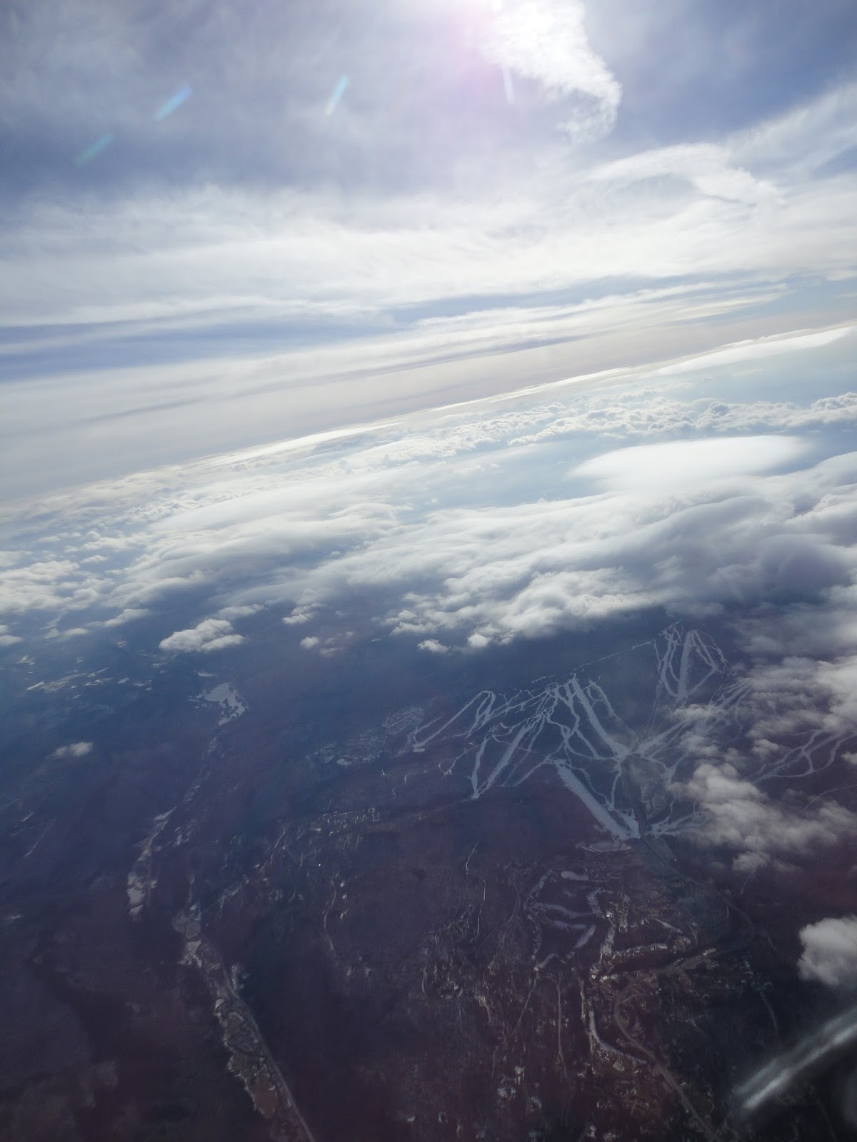
Had another nice wave flight on Saturday.  I took a long tow to the primary but wasn't able to connect so I drop back to Little Ascutney.  From there I was able to thermal into the secondary.  Here is a picture from 8,500' over Little Ascutney looking toward Okemo:


This is the first flight this year where clouds did not obscure the primary around Killington.  This is the view from Plymouth looking toward Killington:


Climbing in the Killington wave to about 12,000':


I followed to the primary to Sugarbush where I climbed to 15,000':


This is the view from Sugarbush looking north.   There was more wave to follow but I was already shirking my tow pilot duties (sorry Walter) and I chickened out.  I turned around:


I got to Middlebury Ski Bowl but the primary hole was getting hazy and heading south with the lowering sun I couldn't tell where to fly to stay in the primary so I headed downwind into a secondary hole.  I got a little lost.  I knew I was 28 nm from VSF (15 nm from 2B9, 11 nm from LEB) and I could see I89 down through the hole but I couldn't tell if the secondary hole was going to lead me too far downwind (like to Sunapee).   I knew I could drop through the hole and land at 2B9 or LEB but I really wanted to get back to VSF.  So I tanked up with a little more altitude and carefully headed south.  At about 20 nm out I spotted the Mt. Ascutney ski runs and knew I was home free.  The hole led me straight back to the airport.  Its nice of the ski industry to create these giant land marks for us but I guess its time to get a moving map display.


- Tim

Sunday, February 7, 2016

Wave Flight - February 4


Nice wave flight at VSF but I had taken my oxygen tank out to get it refilled. I reinstalled it and did a leak check but forgot to turn it back on before take-off. I got to 14,000' then dropped back to 12,000' for the rest of the flight. At 14,000' I was still climbing at 2-3 kts.

Up high the wind was very strong and out of the south. Flew north about 23 nm to Sharon When I turn around the computer said I had a 74 kt head wind back to VSF. I took a long time to get back.

Okemo Mountain's "largest vertical drop in VT" doesn't look so large from here.


Airspeed 70 kts, Groundspeed zero, 5.1 kts on the averager.


I followed the hole left of the 'L' in Lebanon to Sharon.  Could not access the primary because of the clouds.

Tim