The Region 5N contest in Wagener, South Carolina has just ended. Everyone calls it "Perry," after another town nearby, but nobody knows why.
The Perry contest is one of the largest on the US calendar, certainly the largest Regional contest. This year there were 62 entries in 4 classes (Open, 18m, 15m/Std, and Sports). Evan was there in the 18m Class.
Unfortunately the weather didn't cooperate, and half the days were scrubbed. On the three valid racing days, Evan came in 3rd, 14th, and 5th for an overall finish in 10th place. It was a good showing on his part, and his successful use of his powerplant on the second valid day indicates that we'll probably never have to retrieve him again out of Post Mills.
The contest results are here, and all of his flight log files are here.
On April 25, the wind forecast for two days later looked like this:
Recognizing that it doesn't get better than this, Evan dropped everything, planned an out-and-return record flight, and spent the next day driving to Eagle Field in Pennsylvania.
On April 27, he took an auto-pulley tow at 07:30 and proceeded northeast to his start/finish point at Lock Haven. From there he flew about 400 miles to his turnaround point at Gate City, Virginia. He then flew back to Lock Haven to complete the task. He landed back at Eagle Field, after 11 hours in the air.
His total OLC distance was 1436 km, which was the longest flight in the world on that day. The flight should qualify as a new National O&R Distance record.
Here is Evan's account of his July 18 flight, grabbed from the PMSC Forum without his permission:
I took a swing at a 300 km O&R yesterday, Start/Finish at Dartmouth Skiway, turning at Elephant Mountain, which is up in the Mahoosic range. The advantage of this course is that it runs about as straight along the high ground as you can find in our area. The tricky bit is that you really need to be high at the far end. Berlin airport is a useful bailout, but if you can't keep that in range, the other options are generally east of the high ground, in the coastal plain, and if you have to divert, you have a reasonably high likelihood of getting stuck, then subjecting one of your buds to an O&R of a different sort. IIRC it was about 3:20 each way to Thomas airport in Roxbury (2016 or 2017. Thanks Tim).
It was clear pretty much immediately that this wasn't going to be the day. But I thought I'd take a stab at it and see how it went. I had to hang around until nearly 2pm to let the day heat up to make it even semi feasible.
Here's the first glide
The stats are fun, especially the 108:1 glide ratio (I got some orographic help at Moosilauke and Kinsman).
Here are the stats up to the point I abandoned the attempt due to 6000 foot bases nearing Old Speck. I'd already decided I wasn't going past Old Speck unless I had 6500 minimum... and except in really perfect conditions it's hard to see how I could be fast beyond Old Speck unless I had closer to 7500.
If I took the time to fiddle the settings in SeeYou, that "0.01s" thermal would go away, making it three glides with average distance 42.2 km. The reason for all the left turns is that I habitually start my turns upwind when on a cross wind leg.
67mph was a pretty good speed for Saturday, but it was clear it wasn't going to last. I'll try again some other day. Here's the whole flight.
His first leg took him down to Snowy Mountain on the Virginia/West Virginia border, 280 km from home. Then he turned around and flew to Williamsport, Pennsylvania, 360 km. Then back down to the Pennsylvania/Maryland border. He made his final turn at 4:45pm, 145 km from home.
The flight took a little over 7 hours, and you can see from the barogram that he didn't waste too much time in thermals.
According to OLC, this was the second longest flight in the world on May 31, 2020.
A few years ago, the Post Mills XC milk run to Mt Washington started getting stretched routinely to Old Speck Mountain, the highest point in the Mahoosuc Range. Subsequent trips to the Mahoosucs have shown that they can produce good soaring, albeit a long ways off from Post Mills and surrounded by a whole lot of... not very much. To the West is a lot of water and trees and bears. To the East is, well, even further away from Post Mills.
After a particularly lousy, rainy stretch of weather in a persistently wet and rainy Spring, Wed June 7 was mostly dry and Thurs June 8 finally offered the prospect of decent soaring. Club enthusiasm was high. Spring loaded. Turn out was probably a PM weekday record.
Grid Time! First Cu peaking over the hills. What's all that uninvited cirrus doing there?
Clouds just beyond the copper mine -- time to go!
Wind Dummy on tow.
Nine pilots, mostly shirking work. Nine sailplanes. Hopes for an extra early launch were dashed by slow starting convection. This wasn't too surprising given 3" of recent rainfall. Finally, about 1130, the launch begins. I'm the wind dummy. The ride is pretty smooth so I hang on for 3000. Good thing too -- I had to glide about 5 miles West of PM airport to connect. A slow climb of a few hundred feet gave enough extra margin to move a little further West under some early clouds. I soon got up to 6000.
While climbing, I watched clouds form like stepping stones to the North, ending around Spruce Mtn. I'd checked the accumulated precip maps, and straight North was a good (well, less soaking wet) direction. I thought the Connecticut river valley would start slower and although Cu were forming on the high ground East of the River, the quick start was to take this line North. I expected most of the fleet to head towards the Presidential range and the more ambitious guys to head on up the Mahoosucs. I resolved to meet them after going the long way around via the Canadian border. By the time I got to the high ground near Spruce Mtn, my stepping stones had extended Northward and conditions were strengthening.
Moving along well and about 20 miles short of Newport, VT, I reach the edge of the field of Cu and start bearing right. I end up right on the border skirting large areas of overdevelopment(OD) and then over the boonies between Colebrook and Rangely. I fly extra conservative through here, and it goes well.
I get on the Mahoosuc range at Saddleback Mtn and call EA and JD. They are just a couple of miles behind, also Northbound. We don't make visual contact until somewhere NE of Sugarloaf airport. Sugarloaf is about 130 straight line miles from Post Mills and about as far as I ever dreamed I might go today. Now, the real silliness begins, it becomes apparent (we hadn't discussed plans before flying) that EA and JD are on an out and return record attempt. Today!?! Ugh. I know better. My gut told me this morning that this day was apt to shut off early. No sign of that right now though.
Conditions are fantastic. Bases are 10 grand, the OD has simply vanished (when does that ever happen?). Visibility at cloudbase is limited, which conveniently hides the cirrus that must still be lurking overhead to the South. Out of sight... out of our minds! Dan and Greg have water ballast on board. I'm dry, and I have to scramble. Greenville comes and goes... we should really turn around! I'm unwilling to do so on my own. If I bail early, these two loons actually make it around, I'll kick myself for a month. So I continue to scramble, Northeast.
Greenville, ME. Not too many glider pilots have seen this place!
Moosehead Lake. WTH are we doing here...?
About the time we get to Moosehead Lake, Dan asks if I know the VT state free O&R record.
"It's about 500K."
"We've got it then."
"You get it when you get home..."
We press Eastward over Yogi and Booboo country. You can't really fly here except on an amazing 10,000 foot day because there is nowhere to land except widely spaced airports. Mt Katahdin is about 25 miles ahead now, easily visible, massive even at this distance. It's 3pm.
Greg: "Hey Tango, I thought you were going to turn at 3."
Me: "I'm waiting on Echo!"
We're over 180 miles out of Post Mills! Finally we all turn together. My guess is that we might get back to Franconia, unless it's really good, or all goes to hell.
Thermaling up somewhere East of Moosehead Lake. That's T8 at left.
Cruising at cloudbase. Good for the moment.
EA off my right wing near Indian Pond, Westbound, 159 miles out of Post Mills.
View from 8700'.
The first 40 or so miles on the return go well. Fast & efficient, we're really enjoying this ride. Past Greenville, it starts to look like trouble. Sugarloaf Mtn is 100% shaded in OD. Worse, the only sun on the ground leads off into Canada. We can't see much further down the Mahoosucs, maybe it's localized. Later: nope. We get right down on the rocks at Bigelow Mtn, crawl around on Sugarloaf until we all climb out when the sun peeks through, a little. But we're slow and the OD is solid to the Presidentials. The wind shifts from SW to South, and that's even worse news. That's marine air coming in now and it not only kills convection, it's creating the convergence that sustains the OD, even in the absence of convection. Somewhere up on top of the OD is the cirrus deck we ignored earlier. That's three strikes.
Now the real fun begins... where did the sun go?
We struggle to get decent final glides to Bethel. I get a marginal glide, and lose it. Dan gets a marginal glide and squeaks it in, Greg fell off on the first attempt, got what must have been the last thermal of the day to make it. I end up ridge soaring some little spurs, waiting on a miracle or a final decision on where to land. I've been eyeballing a private strip in Roxbury that looks like a great little place, nice house right on the runway. "I bet I'll get a great reception there". Lacking a better idea, I give up and land, roll up into the driveway of the house on the runway. Good call. Minutes later I have a cold beer in hand and some new friends: Douten and Donna Thomas. They'd never had a glider drop in before and thought it was pretty neat.
Once on the ground, it's time to start sorting out this mess we've made -- and it's a pretty big mess by Post Mills standards! I'm 98 air miles from Post Mills, but for a whole bunch of reasons, this retrieve has to be by ground. I guesstimate a 3 hour drive one way, which turns out to be unfortunately accurate. Bethel is about 2.5. It gets crazier: it turns out we've put 6 gliders on the ground away from Post Mills today. DC and NT ended up at Dean, DG in a good field near Bradford in the CT river valley. So some of our ground crew are pressed into service for the second time today. Thanks Pete, Tim, Mark & Sonny. Tim, Mark and Karl (no flight log) are the heros who got home so they could start tidying up
Long way from home...
Tim and I had T8 in the box and on the road at 10pm. We got home... when we got home (it wasn't quite light yet...).
July 5 was a good day for FAI triangles**. Thanks for towing, Rick!
Dan & Greg join the New England 500K FAI triangle club, which I reckon numbers about 8 pilots and fewer than 20 such flights. These guys have it figured out. Superb flying. Well done!
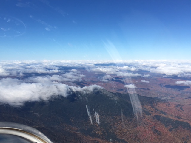
Evan had a good day, as well. Most of the flight was too involved for sight seeing, but the Green Mtns offered "hero conditions" that allowed a moment of relaxation and a few quick photos.
T8 Northbound on the Green Mtns. Mt Snow at center.
Same location as photo above, looking NE.
Same location, looking East.
EA approaching NH's lakes region.
Lake Winnipesaukee as seen from EA.
**For courses under 750km, the definition of an FAI triangle is a course defined by three waypoints, with the shortest of three legs being at least 28% of the total distance. The start & finish points must be co-located, and may be either on one leg or at a vertex. If more than 750K, the definition isn't quite that restrictive, but nothing we've needed to worry about in New England. Yet.
I've been shopping for record weather on the Appalachian ridges.
The forecast surface charts for May 8 had the look of a classic ridge day, with one or two wrinkles to keep me guessing. The low and high pressure centers were forecast to be well positioned & strong enough but very slow moving (not necessarily a bad thing). The jet stream was forecast to track roughly over Tazewell (that is, well South) with 500 mB winds at around a hundred NW. 6000' wind forecast was perfect from Lock Haven, PA to Gate City, VA. Lower level wind forecasts were a little soft and too Westerly. Stability was low, air was dry, forecasting a great thermal day but all blue at the South end. So not necessarily a record day, but definitely a long strong soaring day covering a lot of real estate. I made the decision to go on Friday evening. Saturday I drove to Mifflin Co airport in the rain.
The front blew through Sunday afternoon. A bunch of other New England glider pilots are at Mifflin Co. for a club encampment and we all go fly. I had a nice little rip around Jack's, Shade & Tuscarora, got too aggressive on the upwind transition to Shade at 6pm and landed at Mifflintown airport, 13 air miles from Mifflin Co. That really annoyed me, as the plan was to leave the ship together and watered overnight, and get some real sleep. John Good came and fetched me by trailer, and accomplished the task so speedily that we got back & rigged again in daylight. Watering was put off until after dinner. I hoped that maybe the extra work would make for sound sleep. No dice. I might have slept an hour. I was pretty wired.
Monday morning at 0630, the sock is limp. Reports from Lock Haven, Altoona, Bedford and University Park report similarly light conditions. Darn. I tell (our tow pilot) Brian "no rush". About 0930 I suggest: "Go get your airplane." He laughs (he's convinced this is a dry run), says "I'll go check the ridge", which he does. He returns, reporting that leaves are still. I'm ready and my weather sense says the ridge ought to be waking up about now, so I saddle up and go, getting airborne at 09:58 and taking a 1000' tow to Jack's Mtn. Initial conditions are about 12 - 15 kts WNW with very light convection starting. Brian's right, those tiny new Spring leaves aren't moving at all and it's well short of record conditions.
Moments After the Start. Southbound on Jack's Mtn
My declared course is 1400 km, give or take: Evitts Mtn (South end), Talladega Bowl (near Lock Haven) and Tazewell Gap (Southern VA, a little over 500 km straight line from Mifflin Co). I hit my start on Jack's at 10:04, cruise down Jacks at 80 kts, jog over the Raystown, fly Raystown to within sight of the large open field at the South end, thermal up and make the transition to Tussey... just barely (my inner Flight Instructor is annoyed & says "see me after class, Evan"). Tussey and Evitts go well and nearing the end of Evitts at 11:10 I make the decision to fly the task in reverse order, heading towards Tazewell first.
Anatomy of a Well Executed Upwind Transition. Jack's to Raystown at Mill Creek PA.
The day strengthens. It takes two thermals to cross Cumberland and Keyser to New Creek Mtn, home to 52 new and very imposing windmills. Another thermal to Hopewell Gap, then a continuous run of 93 miles @ 104 mph to Mountain Grove. Turbulence is the speed limiting factor here. Thermals are strong and the ride is getting brutal.
Tilting at Windmills on New Creek Mountain.
A little South of Hopewell Gap. Speed and Beauty.
Clouds end just North of Mountain Grove and it's time to test these blue conditions out, so I climb to 6500 (5.8 kts avg) and glide to Coles Mtn, looking for another climb in the blue to glide the direct route across Covington, high. Ingalls airport (which is on top of a mountain) reports wind 290-ish at 11, which is a little on the soft side for this sort of mission. I shift down a gear. At Coles Mtn, I haven't hit another good climb, so I decide to divert to the Ingalls ridge. I get the thermal I need at Big Knob, then I go back on the direct route (Lick Mtn) just South of Covington. Not in a hurry here. I'm doing a lot of looking at terrain and comparing to all my Google Earth-ing and other recon work.
On the Southern side of the Covington gap is Peters Mtn. If you wanted to build a ridge for speedy and efficient soaring, you would do well to start by studying Peters. Even in today's less than ideal conditions, head wind component and all, it's good for 115 mph ground speed. All I have to do is hang on and keep cinching down my belts. At Tazewell, VA I make the turn at 13:54. It wasn't too hard to resist the temptation to head across the Tazewell gap. I've already signed up for a 500K return flight starting at 2pm. Do I really want to trade up to 650K at 3pm? Maybe not. North I go. On the Northbound trip I've got a tailwind component and I press to see what I can make my glider do. I run out of nerve at 166 mph. It was pretty rough in there! Nearing Covington, the wind slacks off again, but it never gets worrisome.
Seneca Rock (in shadow at center) on the Northbound leg.
Scherr WV Below. New Creek Mtn in distance.
Thermal Soaring Preferred Here!
A 7 kt thermal at Covington, one more near the Hopewell gap and mostly porpoise flying in thermals to Cumberland. Back on the ridges until halfway up Nittany Mtn I throw in the towel, the wind is 270(!) and it's overcast. So I bail on the task (1250 diplome another day...), head down Evitts to collect my last declared turn, jog over to Tussey at Bedback for variety and spend my return trip down Raystown taking in the view and just enjoying the ride. Nearing Reedsville, I spin the numbers on the computer and realize I can probably run up my OLC score to 1500 km by dusk, and that becomes the final objective for the day. It works, rolling over 1501 on my computer about 14 miles out of Mifflin Co. with the sun right on the ridge. The airport beacon lights up as I cross the Reedsville gap, I click the mic to turn on the runway lights, strafe a couple of guys on the tarmac with water ballast and call it a day. I won't be forgetting this one any time soon.
Raystown.
1501 km achieved.
More cool stuff:
Windmills in Motion.
Tearing it up on Peters Mtn., Northbound.
How sweet it is. A half hour segment showing Tussey, Raystown,
Jacks Mtn ridges in (relatively) smooth late afternoon conditions.
Saturday, June 4, my ambition got the better of me and I landed in a field at North Umberland, NH shortly after 6pm, 59 air miles from Post Mills.
I was flying with Greg near Morrisville and I got suckered by some clouds to the Northeast and the six knot thermal I found there. Concluding that the day still had some life, I set off for Burke. Greg, sensibly, headed for Post Mills, it was after 5pm. My plan was to get a climb at Burke under good looking clouds, hit the high ground on the far side of the Connecticut river valley (more good clouds), then glide to Twin Mountain and figure it out from there. The wind was 310-ish at 12, I knew I could expect it to be stronger on the White Mountains, there would be ridge lift and a few isolated thermals on the high ground. I'd get home. It was going to be epic. 500K on a difficult day. Well, not quite.
Arriving at Burke, I flew under what were now tired looking clouds with no lift to speak of. The only decent prospects were to the North. So North I went. Unfortunately, those clouds didn't work much better, so after a brief climb, I took a hard look at the bear country to the East. I could see bits & pieces of the CT river valley between mountains, it looked doable. The flight computer agreed. There were some clouds on the near side of the CT valley I knew I could reach, but I was getting less hopeful about making it all work. Clouds over the higher ground on the far side of the CT valley looked very good. Those slopes were baking in late afternoon sun, but I didn't have the altitude to get there.
Contingency time! I've still got an easy glide to West Burke and Caledonia Co airports, but I'll definitely be landing when I get there. I know the CT river valley has numerous landable fields and heading that way at least offers a chance of continuing the flight. Good enough. Off we go... with only about 4500'.
The rest of the flight was simple enough. I made the West side of the CT and the clouds there gave me a couple hundred feet. Still not enough to get on the high ground across the valley. It's time to re-order the priorities. Time to stop soaring & start landing. I'm well within range of the (abandoned?) airport at Groveton, condition unknown. There aren't any clouds or any other reason to go that way (North) and the airport doesn't have any secondary landing option close by in case the airport for some reason proves unsuitable. The valley in my immediate vicinity has a bunch of decent fields, including some really big, really flat corn fields (newly sprouted, very landable) and this absolute gem of a newly cut hay field. It's airport sized and flat, no obvious obstacles, the approach will be over tall trees (just like home, er just like home used to be!), but no issues at all.
Decision made, I fly across the valley in the rapidly fading hope of getting sucked up those Western facing slopes. I'm too low with about 80% certainty, but no harm in exploring as long as I don't get carried away. I press in next to the mountains and I can feel the air bubbling... it's still working up there alright, but I'm not going to connect -- at least without a little more time to explore -- and I am out of time. I'm right at my comfort limit for altitude and it's time to go.
Back to my field... I set up a high left base, turn final, clear the trees, pick a nice smooth spot.
Retrieve logistics are always a little anxiety inducing. The actual tale is a little tedious. Here are some key words -- you can connect the dots: cell phone, low battery, poor service, text messaging, charger pack, Spot tracker, GPS gibberish (decimal degrees vs decimal minutes vs deg / min / sec), sunset time.
Retrieve arranged, I have some time to amuse myself, so I walk off the landing roll (70 paces), walk the access road (no issues), take some pictures, make friends with the farmer, his wife and kids. I'm told this field is popular in Winter months with ski plane pilots, and I can see why. The kids are eyeballing the cockpit and I don't have to be a mind reader to figure it out. "Would you like to try on the cockpit for size?"
Future Glider Pilots
Lane and Anne played fetch and arrived just after sunset (it's a two hour drive) and we had just enough twilight to get everything in the box. Afterward, we had a nice dinner in Lancaster. It sure is nice having friends willing to drop what they are doing to pitch in and help with a retrieve (I'll promise not to make a habit of it)!
Saturday was a warm, cloudless, wave day. Tim (AT), Tom (2W), Dan (EA), Evan (T8), and Jerry and Larry (i1) flew out of Springfield VT (VSF) with the assistance of Andy L. in the Pawnee. Evan found the highest climb to 16,000'.
I (Tim) took the first tow around 11 AM followed by Tom. We found week wave to 8,500'. I was in the primary and Tom in the secondary. At 12:40 the wave shut off and sent us scrambling to find lift. I hung out by ridge soaring the west face of Okemo until the wave lift returned about 20 minutes later. Tom never fully recovered and landed about an hour later.
I found the Okemo wave to have a very short wavelength. My climb was only 2.5 nm from the summit and I found lift as close as 1.6 nm (over the base of the ski lifts) from the summit. Evan and Dan's climbs were about 3.5 nm from the summit. Once I topped out at 9,000' I headed for Killington. Thinking the wavelength for the day was short I stayed to the west of Rt 100. I was rewarded with sink all the way. At 6,000' I was just about to head back to VSF when I found the Killington wave. Evan and Dan followed a line further west to Killington and did much better.
Dan topped out at Killington at 12,500' and lead the way to Sugarbush. Evan stuck around a little longer and got to 16,000'. Dan, Evan and I found our climbs 4 nm - 4.5 nm from the summit, so it looked like the wavelength was longer than Okemo.
At Sugarbush we all found climbs right over the airport at 5-5.5 nm from the summit to about 15,000'. We all continued north but Dan was the only one brave enough to hop the I89 gap at Waterbury. Dan made it up to Mt. Mansfield but could not find the lift and had to land at Morrisville. Evan and I stuck our tails between our legs and headed for home.
The wind was a bit out of the north and made the return to VSF easy. From Sugarbush to Killington I gained about 500'. From Killington to VSF I flew as fast as 120 kts IAS which worked out to 153 kts TAS or 176 mph. With the quartering tail wind the ground speed hit 216 mph! Evan and I landed about a half hour after Dan. We packed everything up quickly and I was off to get Dan.
My new theory about wave in the Green Mountains is that the best lift is at the major ski areas (Okemo, Killington, Sugarbush and Stowe). The best terrain for skiing (tallest peak, moderate steep slope, bowl shape) is also the best terrain for wave. As an added bonus 3 of the 4 ski areas have airports near by.
Our club is very lucky to be made up of so many dedicated volunteers, and the secret to our success is the willingness of everyone to help everyone else get in the air.
Yesterday and today, this volunteerism was exemplified in spades by two of our members, who successfully made the transition from "Expert Pilot" to "Rookie Flight Instructor."
Congratulations to CFI Evan Ludeman and CFI Moshe Braner!
Becoming a Certificated Flight Instructor isn't easy or cheap. Knowledge, experience, and skill are only the beginning. You have to have a Commercial Certificate and then pass two more written tests and a flight test administered by an FAA Flight Inspector.
Moshe and Evan spent a week at CFI Camp in September and completed their Commercial Certificates at the end of that month. Then they sat around and waited for a month for the FAA to find a qualified Inspector, eventually choosing the obvious guy, the only one within 1000 miles of here.
The two flight tests went very well, unsurprisingly, and Evan and Moshe can now transfer their expertise to you, complete with a signature in your logbook.
CFIs are not all alike, and we are fortunate to have these two in our club.
Evan and Moshe will make us all better pilots, and they will do way better than whoever soloed this guy:
My season opener didn't occur until I got to Perry, South Carolina, for the Region 5 North contest that I am fond of attending in April. Unfortunately, due to a rained out practice period, I didn't even get a chance to fly until the flag dropped for the opening race! Even "better", it was a windy blue day and I ended up flying all by myself after a late start. Predictably, it ended early.
Here's the whole flight in SeeYou:
Here's the overhead of the end of the flight, North is up:
I thought I might have been flying between streets of better air, hence the 90 degree jog. It didn't work, but it was a good thing to try.
Wind was 280 at 10 - 15 knots on the ground, about 23 knots at soaring height.
Cross country flying is all about decision making and "gear changes" or transitions in your thought process. The 270 left turn at lower right marks the gear change from "I'm racing" to "survival" and "I might need a place to park" mode. The last two circles are more about field selection than they are trying to climb. The point that I quit circling and over fly my eventual landing site marks the transition from "I'm trying to soar" to "I'm landing, right now". Making these transitions in a decisive manner at appropriate times is one key to safe cross country soaring.
By the way, be sure to fly a normal size/shape pattern despite the fact that your intended field might be pretty small! SeeYou says that field is 860 feet long and I'd guess that the trees on the approach end are about 50 feet high.
Here's the landing site:
Thanks to Marshall McClung for retrieving me and sharing soaring stories over Mexican food and margaritas.
In other news, our friend Sarah Arnold is headed to France to represent us at the Women's World Gliding Championships, where she will be flying a Libelle in the Club Class. You can read about her here and here and on the US Team Twitter feed, after the contest starts (June 29).
And Evan is geared up and ready to do battle at the US National 15 Meter Class Championships in Hobbs, New Mexico. He will be busy flying for the next 12 days, but if he sends any reports or photos, they will be published on this blog. When that contest starts (June 25), the official daily results will be published here.
I'm uncertain what happened at Gorham early in the inter-weekend period because I was breaking rocks "down South", which is to say I was working in the general vicinity of Epsom, New Hampshire. I did hear that there was flying both days including some light wave in easterly winds.
The forecast for Thursday was for a rather more serious Mount Washington kind of traditional post frontal wave, so I headed back up north Wednesday evening, just a little too late for an evidently excellent spaghetti dinner at the red house.
Thursday was cold (as predicted) and windy (as predicted) but the wave was a little weaker than one might have guessed based on the forecast. Conflicts with other users of the airspace (F-16s) were therefore not as annoying as might have been because it just wasn't the really "tall and strong" day we were hoping for. I flew up to perhaps 16K where the winds aloft were 85 plus and enjoyed the view, but wished for a go-somewhere day. After flying, I ended up at the S-a-a-l-t Pub with a bunch of others, where the menu is worldly and interesting, and the food quite good.
Friday promised lighter winds and potentially better x-c wave, but it came with a lot of cloud, bands of snow showers and low visibility. At least one glider (I1) got high enough to clear the weather and had an extended high flight, but climbs were weak so later launchers including T8, RR (flying the Puchacz),18H and PM had to dive back under the clouds and seek some place to wait out the snow showers. It didn't work. T8, 18H and RR headed for Hayes, PM (Tim) headed for Mount Madison. We all gave it up in turn and landed without incident, but Tim landed at Whitefield just to be different.
Saturday was forecast to be drier, so several of us decided to rig early. T8 was first to launch around 0930, not exactly dawn patrol but at least early enough to catch a beautiful view of mother earth with the sun still low in the eastern sky. Visibility was absolutely superb. Unusual for the weekend, F16s were practicing in the MOA again, so the wave window was unavailable until late. Iron man Pete took off just before lunch in LT and toured the area for almost five hours. Andy made it to 14000 feet in PM, and as soon as he landed, Greg took over and squeaked out a Gold Altitude climb (3033 meters, pending approval).
Several pilots enjoyed playing around in the Crescent wave to a maximum of about 13K and others flew the Mount Washington primary right up to 17,999. I paired up with RR, shot a little video, and we flew off on a daring O&R to Berlin at the breakneck ground speed of about 35 knots (with a headwind component of about 70).
Cross-country not being the order of the day, RR decided to make an attempt at a "legal diamond" by flying to a low point on Mount Hayes and then digging back out to get a 5000 meter climb all below 18000 feet. I thought that sounded like fun so I headed down to do likewise and found the low level ridge to be exceedingly rough and a little too sporty for my taste. "S" turning on Mountt Hayes below 1600, I found wind shear that twice attempted to roll me well beyond my intended bank angle, so I called it quits and landed in time for a late lunch.
In the meantime, Skip (JS) took a fashionably late tow to the primary and was able to get over 13000 feet. It turned out that this was the last good climb of the day (and our first OLC claim of the season).
Late in the day, the wave window was finally open and I took another flight. Several of us did battle with a powerful primary rotor, but none were able to connect with the wave. Doug flew 3J, but he didn't record the flight, and I don't have his report. Dan and John Good gave it their best shot in the Duo, but the wave was gone. I found a lovely thermal cloud street to Mount Starr King and back, then capped off the week with a beautiful ascent of the Presidentials in ridge lift at sunset. After waiting all day for his turn, Dennis took Rick for a nice tour of the valley in I1, and by trying every peak on the Moriah-Carter range, they confirmed that even the ridge lift was gone.
The forecast for Sunday was so hopeless that even the optimists thought it would be a good idea to break camp. Andy led the 3J disassembly crew, Greg and Dan packed up the golf cart, and Rick, Dennis, and Annie moved the airport cones back in the way of safe operations. Walter made his ceremonial low pass in the Pawnee at sunset, and that was that.
So ends another successful wave camp, thanks to everyone for helping out and staying safe.
We adjourned to dinner at the delightful Saladinos Italian restaurant and market and took our leave by turns. Several of us cleaned up the red house and the stragglers held an impromptu debrief while waiting for Felix Baumgartner's balloon to ascend to 128,000 feet for his record breaking jump.